I have a lot of photos from trips I've been on that I have never put on Steem before, so I thought I'd share a past adventure from April 2018 when I went on a walking holiday in Snowdonia, Wales. I thought writing about it might also be a nice experience as it makes me relive my memory, recalling every step! Therefore I thought it might be nice to start a hashtag #epicadventure to create a topic of epic adventure posts, giving you the opportunity to relive some great experiences in a blog post.
I had only been to Snowdonia once before and that was to climb Snowdon, the highest peak in Wales and a popular mountain for all people to climb, or not, as you can get a steam train to the top, but that's another post! I was therefore excited to check out all of the other mountains that weren't so well explored. By the time of this walk we had been in Snowdonia for a few days already. Having already climbed Snowdon and Pen Yr Ole Wen (strange name!).
The route we did was relatively short at only 6.3 miles, but due to the icy weather it literally took all day, but what a day! This was probably the best hike I've ever been on. Breathtaking views in every direction, a bright, crisp day and some snow on the ground it was picture perfect.
The plan was to first climb Tryfan, then onto Glyder Fach and finally Glyder Fawr before coming back down via Llyn y Cwn and Llyn Idwal (lakes) and getting back to the car. Although the highest peak of Glyder Fawr was 1000m, the car park was already at 350m, so we only had 650m to climb - nothing I hadn't done many times before, but the ice was going to make this one a lot trickier!
This is a map of the route. You can interact with the map if you follow the plotaroute map link here:
https://www.plotaroute.com/route/988596?units=miles


We exit the car park, start on our march to the top of Tryfan and look up. I take this picture as the sun rises up from behind the mountain. The path actually circles around the back of this view, but it still isn't much easier than this looks!

Half way up we take a moment to turn around and take in the view. It's breathtaking, and we are only just beginning.

Looking down the valley you can see the river Afon Ogwen run down toward Bangor which is located on the north west coast of Wales.
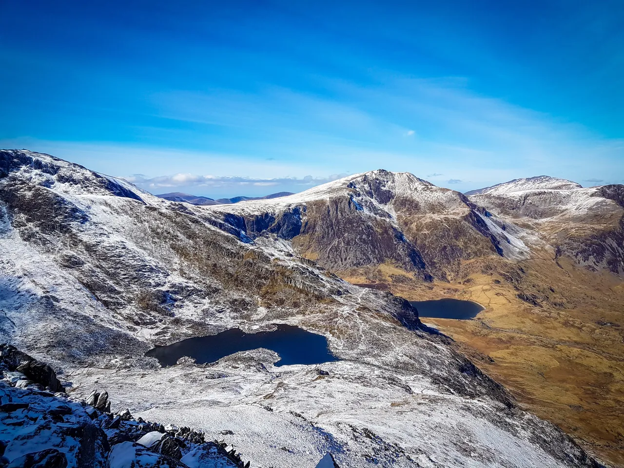
Looking over to the left you can see the lake Llyn Bolchwyd and the peak Y Garn.

Ted finds some steady ground. Quite often on this climb the path became so icy we had to navigate around it which felt a bit treacherous at points. A couple of parts the step up was too much for the dogs to climb on their own so I had to lift them up by hand. It was getting a bit dicey, but the way back down looked equally so, so we continued on up.

Isaac admires his kingdom. This is his mountain.

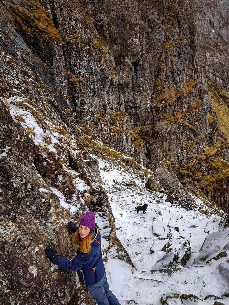
Tryfan didn't really have much of peak that you could say was the top. The top consisted of lots of different rocks jutting up out of the ground, with no flat surface of any real kind. As we reached the top we looked down the other side of the mountain; what a drop! This is the side the real mountain climbers come up using their ropes and pickaxes.

Being at the top felt great. We had got past the steepest ascent in the walk and the sun was shining on us so the ice started to melt a bit making for slightly easier and safer hiking. We looked over to where we were headed next; Glyder Fach, and Glyder Fawn beyond it. First we had to climb down off the back of Tryfan in order to climb up Glyder Fach - a 200m descent and then 300m back up. We had planned to climb straight up the face of it that you can see here, as there is a path you can follow, however due to the conditions we decided to take a less direct, safer route, bearing left and then around the back of it.

We turn back to look at Tryfan. A mighty mountain and one I feel proud to have conquered! It's a very majestic looking piece of rock. Like a wales fin cutting through the waters surface.

Facing forward once more we march up the back of Glyder Fach. The path here was quite icy so we had to be careful. You can make it out on the left of this photo.

We reach the top of the path and have to scramble over large swaths of ice covering the entire edge of the mountain peak. It looks like it should be soft snow, but when you place your foot on it it is rock solid ice. You really have to dig your toes in to get a grip!

Finally we reach the top of Glyder Fach, a height of 994m. That was virtually all the climbing done as the next peak was just along the ridge line, at only 6m taller. What a relief! We stop for a much needed refueling.

Ted takes in the views looking over Snowdon, the highest peak in the country.
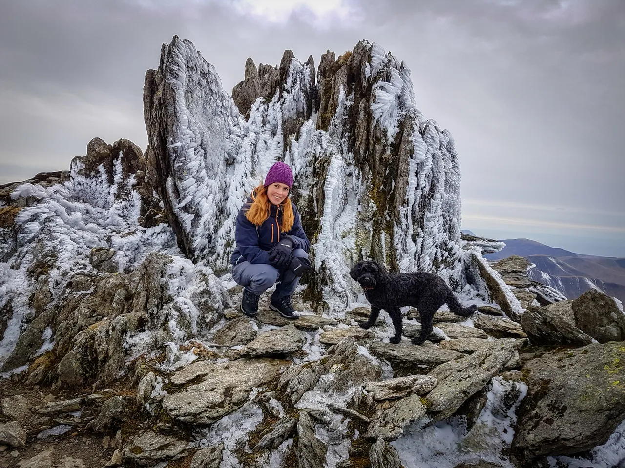
Here we are at the top of Glyder Fawr at a nice height of 1000m. The wind was quite strong up here and you can see how the rain and wind formed sharp icicles all over the rock. Bex and Isaac pose in front of the summit.
We begin our descent. It's steep, but the ice doesn't last long. The sun had been on it all day at this point too so it had become more slushy, allowing for a better grip. The rock faces are epic.

This rock signifies a split in the path. One way descends down to the right evenutally skirting the right hand side of the lake, with the left path doing the same to the left. We chose the left :D

Down at the lake side the dogs want to play "throw the stick in the water". I don't know where they get the energy after a hike like that!

Just before the path joins back to the car park we take one last look up at Glyder Fawr as the sun starts to set behind it and feel accomplished. With the mountains towering around you it feels great to know you have just conquered them. What a walk! What a memory. What an #epicadventure


