Another post in my "biking to work"-series - yesterday I took a quite big detour to get to work - the whole route was like 16 km while the distance by straight line to the office is a mere 6.5 km, so roughly 2.5x the air distance. I spent a bit less than an hour on this trip, with the electric bike. There is quite some up and down, I start at 150 metres above sea level, when I get out of the forest and onto paved car roads I'm at 305 metres above the sea level, and when I end the trip I'm down to 112 metres above the sea level. The trip is beautiful, fresh air, lovely lakes and the downhills in the end is crazy. I have a speedometer on my bike, it stops working at 47 km/h - I've probably been rolling around 60 km/h in the "worst" downhills. Due to all the uphills in the beginning of the journey it takes quite much longer time with a regular bike.
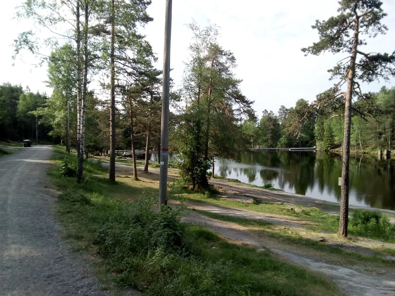
Here the forest starts. This is an artificial lake, "Badedammen", or "the bathing pond". It was made after the popular bathing lake above it was made into a drinking water reservoir. Behind the dam in the end of the picture it's a parking lot.

Here is a bit of the road as well - this is the standard for the forest roads in the area. The general public is not allowed to drive cars or motorbikes here, but there are some exceptions, like for people working or living in the forest.
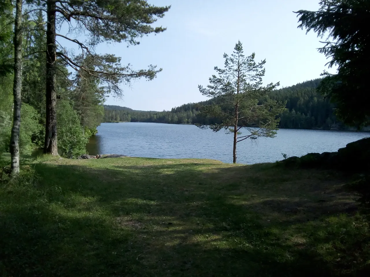
Here is the lake above - "Steinbruvann", aka "Stemmern". It's not used for drinking water anymore, so now it's back to being a bathing lake - and it's great for that purpose. It's more than a kilometre long. The lake was divided in two by a stone causeway (hence the name ... stone bridge water), but this one is now some few metres under the water due to the dam that was built when the lake was made into a drinking water reservoir.
A random pique-nique bench on the way. I'd rather take my lunch at a place with a view to a lake than here, but that's my personal preference. The black spots are from people making fires in the winter time. Currently the risk of a forest fire is "extreme" according to Norwegian standards, there is even a temporary ban on grilling.

I passed quite some lakes on the trip, but didn't get time to photograph them all. By this lake there is a sign that the lake is used for drinking water, hence activities like camping near to the lake is prohibited. Around some of the lakes there are also fences, and along the fences there are typically some gates that are opened up in the winter time to allow the skiers to take shortcuts over the lakes.

A clearing and a signpost. There are signposts everywhere along the roads and significant paths.

Here I've just left the forest road, at Solemskogen. There is still some few km of downhills left through the forest, but on asphalted road where the public is permitted to drive cars. I failed to take photographs in Solemskogen - it's a settlement in the forest zone ("bydel marka" - or "the forest city district"). There are strict regulations for constructions etc outside the "forest border", though people are allowed to maintain and renew what they already have.

Here is the next lake, along the paved road.

There are some really nice views along the route, but really difficult to photograph. When biking, the trees are like a blur and one can see the view behind. When one is trying to stop and take a photograh, one cannot see the view except for the trees (and even when seeing the view, it's rarely as magnificent on a photograph as in reality). If you can manage to see something blue on the photo below, it's part of Maridalsvannet, one of the biggest lakes in Oslo and also the most important drinking water source for Oslo.

The forest border was crisp and clear ... and now I've left the forest, but there is still quite some view. It's a bit easier to take photos between the buildings than between trees, but still one gets a better impression of the view while biking than while trying to take photographs.


All photos available in better resolution on IPFS QmNoJLtd1JPv38eZ7DJDk3fsoG1AAnYTERFeEQc3DKGHEj. License: CC BY-SA 4.0