Hello to you all walking your first #WednesdayWALK for 2022!
I hope that you are all well and had a brilliant New Years Eve and ready to tackle the adventure that I’m sure 2022 will be.
I left my lovely little Spike and his cousin Lilly in my home town and traveled back to Melbourne on the 2nd of January so I could go back to work as I’m still trying to recover financially from the last lockdown we had.


And so jumped back on the bus for 4.5hours, then eventually met the train and boarded that for another 4.5hours till we reached the original starting point- Southern Cross Station in Melbourne.


Here are some photos of the journey, including our lunch break in a historic little town called Cann River, where I was able to take and walk and stretch my legs for 30mins in the 30+ summer heat (it's finally HERE...wooohoooo....I LOVE SUMMER (and the heat!)
The township of Cann River is situated at the junction of the Princes Highway and Cann Valley Highway, 455 km east of Melbourne. The town is named after the Cann River which flows south from the Victorian-New South Wales border, reaching the sea through Tamboon Inlet. The river’s name is thought to be an Aboriginal word of unknown meaning.
Two pastoralists, Allen and Stevenson of Twofold Bay, grazed cattle in this area as early as 1841, but the run was abandoned as Aborigines speared large numbers of their cattle. A later squatter, Alexander, experienced similar difficulties and is reputed to have retaliated by shooting many natives. The Aborigines were of the Bidawal tribe, a small group regarded as outcasts.


When the Morgan family, the last runholders, took up Cann station in about 1879 the area was still very isolated. They had to cut their own track for 96 km from Marlo to the west. After surveys enabling selection, the Morgan family selected further land. Other settlers arrived from the mid-1880s to early 1890s.

Morgan's homestead was the focus of the small community, being the location of the post office from 1890. Around 1900, a small settlement developed 9 km to the north. A store, school, church and hall were soon serving the area which by 1911 had 163 inhabitants. Most settlers had cleared small areas along the river valley. Pigs, fattened on maize, were the most common livestock. Cattle were run in the bush and many farms also had a few dairy cows.

Cann River residents had built a school building in 1926 which was replaced by a government school in 1937. A medical building was also constructed by local labour in the late 1920s. The Bush Church Aid Society, a Church of England organisation based in Sydney, provided nurses. St John's Anglican Church was built in 1928, with funds donated by Edith Reece, an English woman who worked as a deaconess at Cann River from 1922 to 1932. The lych gate, opened in 1947, is dedicated to the memory of three pioneers, including Edith Reece. The area was still very isolated. A bridge was built over the Cann River at the township in the late 1920s but roads were poor, being only narrow tracks.

From the 1950s the Cann River district experienced considerable growth. Several sawmills began operations, cutting from private properties and later from Crown Land. These mills attracted new residents, many being European migrants. In 1977, there were five mills, the whole industry employing about 80 people. In the late 1970s, the Forests Commission established an office there. Most of the Cann Valley is state forest. Noorinbee remained basically a farming community, but also experienced growth at this time.

Until 1952, Cann River school had only one teacher. By 1961, there were three teachers and two additional classsrooms for the 79 students. In 1965, classes were established at the secondary level and TAFE later established a branch. The medical dispensary and nursing service closed in 1964, but in 1972 the Cann Valley Bush Nursing Centre commenced operations. A sports arena was cleared in the early 1950s and the hall opened in 1958. The district was connected to the state electricity grid in 1970.

Bushfires and floods are an ever present threat in this area. Severe floods have occurred regularly over the years. In 1983 the Cann River district was devastated by a fire which burned for many weeks and fire breaks out in most summers.

By 1979, the district supported a population of 338.
The farming and timber industries continued to provide the main employment but tourism became an important source of income. Travellers to Canberra and the south coast of New South Wales break their journeys here. Cann River is also a convenient base for fishing and boating at Tamboon Inlet and bushwalking and camping in Croajingolong National Park. By 2011 there was one sawmill left, and food outlets had increased from three to six.

In 1928 a large brick hotel was built to the south. The Princes Highway was routed that way and another community began to develop there. To distinguish between these two townships, the earlier Cann River settlement adopted the name Noorinbee, an Aboriginal word of unknown origin, which was already the name of the parish.


Cann River has a hotel, two motels, a caravan park, a small supermarket, three motor fuel stations, an Anglican church, two halls and a Prep to 12 school (47 pupils, 2014). Noorinbee school stayed open, with an enrolment of 6 in 2014. https://www.victorianplaces.com.au/cann-river

The Cann River catchment (1,167 km2) comprises the forested upland areas on the Victorian and New South Wales border, the cleared agricultural land on the floodplain around Noorinbee and Cann River township and Tamboon Inlet on the lower reaches of the river.
The river is formed at the confluence of two streams – the East and West branches of the Cann – at Weeragua, flowing into Tamboon Inlet, a coastal lagoon that is intermittently open to the ocean.
The public land in the catchment includes sections of Coopracambra and Croajingolong National Parks.
These remote areas include eucalypt forests, heathlands, rainforests, granite peaks and coastal headlands. These ecosystems support a diversity of flora and fauna, including 328 fauna and 1000 flora species recorded in the Croajingolong National Park.
The fertile Cann River floodplain mainly supports dairying and beef cattle grazing. The small township of Cann River, located at the junction of the Princes and Monaro Highways, is a rest stop for interstate travellers and a starting point for visitors to the Coopracambra and Croajingolong National Parks.
Tamboon Inlet is a haven for camping, fishing and bushwalking. It is recognised as a high-value wetland in the Directory of Important Wetlands. The outlet into Bass Strait is subject to periodic closure due to variations in river flows and climatic patterns.

In recent years, a ‘natural healing approach’ has been taken to rehabilitate the river. Vegetation has been allowed to encroach into the river channel to capture and stabilise sediment (sand). Rock chutes and pile fields have been constructed to stabilise the river bed, retain sediment and provide a suitable environment for reeds and other aquatic plants to become established.

Native trees and shrubs have also been planted to stabilise the banks. Fences have been erected along the river to prevent stock eating and trampling new plants including those that have regenerated naturally. https://egcma.com.au/rivers/cann-river/

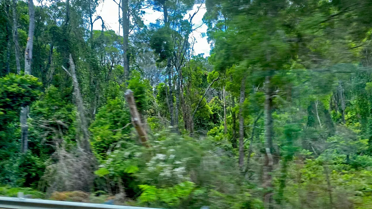
And this simply beautiful sub temperate rainforest that we zoom past by from the windows of the bus.

And after that long but wonderful journey through gorgeous sub tropical temperate rainforest, dry, sunburnt bush, much of it still black, scorched to the bone from the bushfires exactly 2 years ago, flat plains as far as the eye can see, clear skies that reach the tips of the distant mountains, extraordinary colour in the flowers and all of the surrounding landscape we pass, Suddenly (after 9hours..lol..) I'm back in another reality, like an arrival from a dream into a parallel universe to this breathtaking scene- Southern Cross Station.


So I hope that this made you smile like it does 

Thank you so much for reading my post , I really hope that you enjoyed it and look forward to your comments and thoughts.
🐠🐃🐌🕷🐍🐓🦆🐸🐁🐿🦋🐢🐞🦍🐈🦆🐥🐜🦑🐛🐄🦇🐪🦏🐳🐊🦀🦌🐖🐢🐏🐋🐝
And unless otherwise stated- ALL photographs, all media, material and writings, are all my originals taken by me sometime in the past few decades or so somewhere in my travels and as such, ofcourse they are subject to all international IP and copyright laws and I may have already used them for my own commercial purposes here https://www.redbubble.com/people/CHOCOLATESCORPI/shop And here https://fineartamerica.com/art/chocolatescorpi, So please ask first if you want to use any of them as we wouldn't want you getting into trouble. Thank you 😊
🐠🐃🐌🕷🐍🐓🦆🐸🐁🐿🦋🐢🐞🦍🐈🦆🐥🐜🦑🐛🐄🦇🐪🦏🐳🐊🦀🦌🐖🐢🐏🐋🐝
The Ladies of Hive- your own crypto world girl gang full of fun and suprises, so click on the link to find out more about this brilliant community of caring, companionship and creative contests, such as this one...@ladiesofhive/ladies-of-hive-community-contest-64


(cause we're all such damn cool cats...😁

Please feel free to checkout my other colourful, creative fun stuff and work on
https://chocolatescorpionc.wixsite.com/chocolatescorpi
https://www.redbubble.com/people/CHOCOLATESCORPI/shop
https://fineartamerica.com/art/chocolatescorpi
https://deepdreamgenerator.com/u/chocolatescorpi
https://www.instagram.com/rawscorpi/
https://www.instagram.com/chocolates.scorpion.creations/
https://www.behance.net/chocolates0386/projects