After 4 years, I had the opportunity to come back here. The place that marked my very first steps in the volcanic area. Up until that time, volcanoes were just images on movies or TV to me.
I remember vividly the moment when I stood still and looked at exotic volcano cliffs under strong wind, I saw everything so magical. I told myself that one day I would come back to experience this feeling again. And it took me 4 years to achieve what I had promised.
If you want to learn about Tongariro Alpine Crossing - where it is and why it is a famous destination in New Zealand - you can read my article about this mountain here . In this post, I would like to focus on sharing specifically about the journey to climb this sacred mountain on the first day of 2022.

The shuttle bus picked us up at 6:30 am at our place. Luckily for this time, we booked a homestay with a local family and they have a company that transports climbers to Tongariro Alpine Crossing. So we can freely choose the time and do not have to worry about where to wait for the bus.
After around 40 minutes, we were at the starting point of the climb. As expected, the weather on that day was very nice for climbing. Steve - the driver and also the host of our place - told us that there won't be too many people climbing on the first day of the new year so it was a great opportunity to enjoy this beautiful hiking track.
He also did not forget to instruct us on what to do if we were in danger. Steve said that this is an active volcanic area, although there were currently no danger warnings at that time, we should always prepare for the worst-case scenario. If a volcano erupts, stay away from the valley areas because that's where the lava will flow.
He also mentioned that the area to be extremely careful during the climb is the path from Red Crater going down to Emerald lakes. Easy to slip and fall. Before saying goodbye, we asked Steve to take a commemorative photo at the starting place to see how excited we were and then we would ask him to take a photo at the end to compare. Just for fun.

Our starting point - 0km down, 19.4km to go

Yes we are, can't wait to start the hike
Looking at the clock, it was 7:15 am, the sun had risen quite high, so I missed the captivating scene at dawn that I always wished to return to 4 years ago. Since we didn't have enough time to have breakfast at our accommodation, we decided to stop at a hut for a quick meal and apply sunscreen.

Early view of the Sunrise 4 years ago

Unfortunately, I was too late for this time
Stage 1: Mangatepopo Road End To Soda Springs
Thanks to my first climbing experience, I knew the first part is quite easy and suitable for us to warm up. This was also a great opportunity for me to enjoy the beautiful landscapes on the very first morning of 2022.


The first part is fairly flat, well-formed and board walked in damp areas to provide stability underfoot

Continues up the valley, following the Mangatepopo Stream and around the edge of an old lava flow


A change in plant species along the track.


We were so lucky to catch the magical moment when the sun rose above the top of the mountain
Stage 2: Soda Springs To South Crater
After 2 hours of nonstop climbing, we stopped at the last toilet facility of this part to rest and eat some snacks. It was the last place where we could use the toilet because there won't be any for the next 4 hours.
The next part of the journey is called the Devil Staircases, this is a vertical climb with many steps one after another straight up to the blue sky. Due to the practice of climbing for several days before the trip, I did not get tired of these stairs. My friend, however, did not prepare well. She was exhausted, climbing step by step was difficult for her. Fortunately, my friend made a strong commitment to climb this mountain. She took a break every 10 steps and we always waited patiently for her. It took us a long time to finish this part, but thanks to that, I had the opportunity to feel and see the scenery more clearly.

Start of the Devil's Staircase, which is steep - climbing from 1400 to 1600 metres above sea level.


Taking a short break to catch our breath and enjoy the view

The view down the valley and out across the surrounding countryside with a glimpse of the perfectly formed volcanic cone of Mount Taranaki.

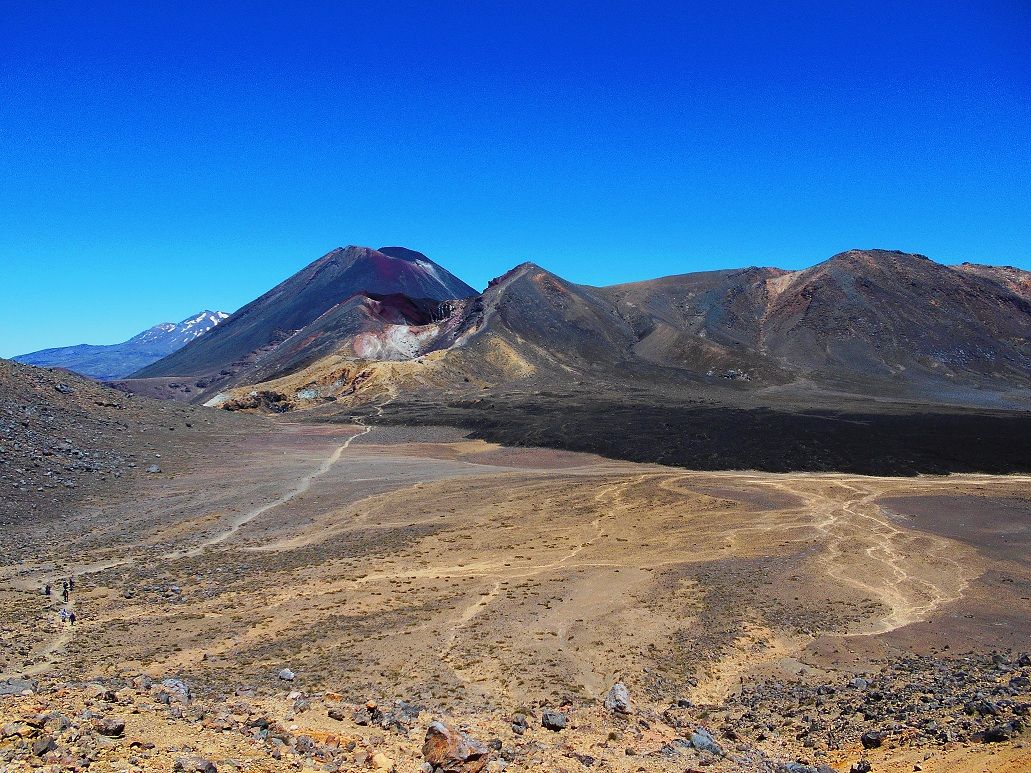
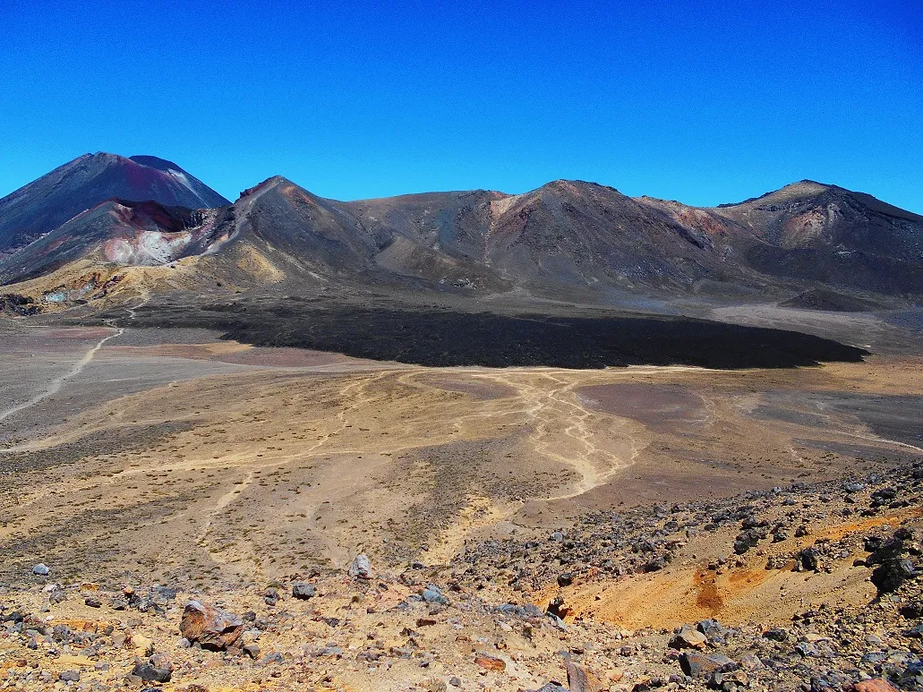
After the vertical hike, we were rewarded with a splendid valley view between volcanoes.

Our second time here - this is one of the three areas I like the most in my journey, never get bored looking at it.


Plus the majestic scenery surrounding me made me once again feel like I was on another planet.

Ngauruhoe mountain now stands tall and challenges me to conquer it. However, the Maori iwis decided to permanently close Mt Ngauruhoe hiking track because it is a sacred mountain in Maori culture and they do not want tourists to litter on that mountain.
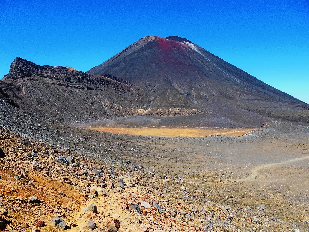
Stage 3: South Crater To Red Crater
The third part of the journey is climbing the Red crater. This is the area where the volcano erupted most recently in 2012. We can see the remnants from that eruption.

My friends and I enjoyed the flat before starting a short climb on an exposed ridge, the track follows this ridge to Red Crater.

Do you see what I see? It looks like the entrance to Modor

This scene blew my mind away. Both my partner and I couldn't remember seeing it on our first time

Volcanos's ash and rock
The best thing about conquering the Red Crater is being able to observe the famous 4 lakes of Tongariro Alpine Crossing and the 360-degree landscape from a height of 1868 m. I can see the volcano thanks to the closer distance and altitude. Be blown away in the grandeur of creation with surreal scenes. From here, I began to smell the sulfur of the volcanic area.
It was a beautiful day to do the climb. The sky was blue with no cloud, plus the bright sunlight made the scene appear more clear. Remembering the last time I did this hike in 2017, my friends and I had to cling to each other to not get blown away, this time I was so grateful to be able to admire the beautiful scenery.


Enjoy spectacular views out over the Oturere Valley, Rangipo Desert, Kaimanawa Ranges and down towards the Emerald Lakes
Stage 4: Red Crater To Blue Lake
Because this is a dangerous area, I didn't want to stay for long. Also, remember Steve told us the descent from Red Crater down to the Emerald Lakes is quite steep and very loose underfoot. It is the most difficult and dangerous part so we should take the time to climb down.
As expected, both I and everyone around me was struggled to get down. It was so easy for people behind and in front of me to fall. The strong sulfur smell together with the dust hitting our faces through the wind or whenever someone felt, made this part unpleasant to all of us.

I discovered a very effective way to climb down is to follow a zigzag path, thanks to which I only fell twice.

View of the crater when we started going down
After struggling for a while, we reached the flat area near the lake. I wanted to continue climbing the Blue lake and would have lunch there because it is a safe zone if the volcano erupts. Just kidding we want to avoid the smell of the volcanic area.
But everyone was starving at that point and didn't have the energy to go on, we decided to have a quick lunch right next to the beautiful lakes. While eating, I secretly admired myself for having overcome a difficult challenge on the first day of the new year.


Look, we had been climbing down from the top of the crater. You can see the line of people getting down on the top right corner of the photo
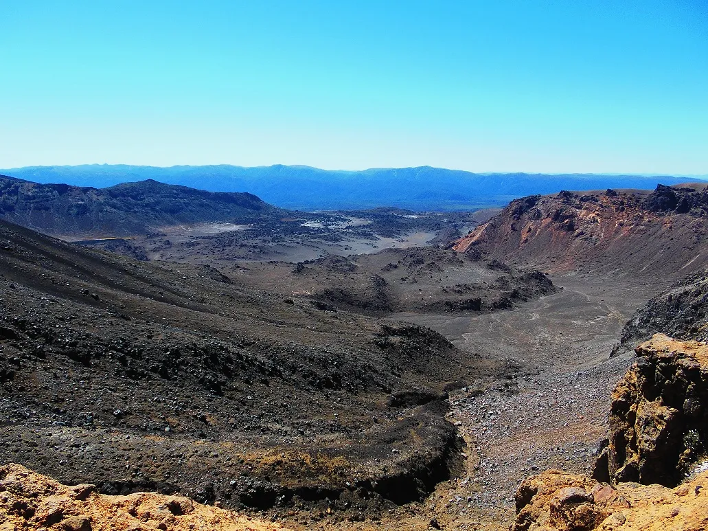
The distance from here to Blue lake (a cold acidic lake) crosses a large valley. I had the opportunity to see the majestic volcanoes from a different angle. This time, the scene of the erupting volcano appeared more clearly through the lava layer near the foot of the mountain.

An old lava flow from Red Crater spreading out across the floor of Central Crater

Here we go, the Blue lake - a cold acid lake
Because I had just finished lunch and was also tired, the steep steps to the Blue lake were quite hard for me. Check-in time was almost 1 pm, it is usually my nap time at home. We had climbed more than half the journey. According to Steve's estimation, it would take us about 3 hours to complete the climb. He also joked that on average people will climb for about 6-8 hours, he gave us 9 hours to finish this hike.
Stage 5: Blue Lake To Old Ketetahi Shelter Site
Everyone said it was an easy part and a good opportunity to see the sights. But that is not the case for me. Because I often take a nap, this time I am quite sluggish, plus from above I can see the winding road up and down. I lost my excitement and just wanted to complete the journey. It was a hot day, there was no shade on the road, the whole group was tired but still encouraged each other that we were about to complete the journey.

Spectacular views out over Mount Pihanga and Lake Rotoaira across to Lake Taupo


Stage 6: Old Ketetahi Shelter Site To Ketetahi Car Park
Fortunately, the end of the journey is a shady forest. Next to the road, there is a murmuring stream that sounds very pleasant. Seeing a group of children lingering around playing in the water, I was intrigued to join them. However, it was close to the appointment time with Steve, we didn't want to keep him waiting long, so we quickly completed this final part.

Finished the hike after 9.15 hours of climbing, when we arrived we saw Steve was waiting. He also very thoughtfully brought cold water for us to drink to relieve fatigue and happily took the last photo to mark our first success in the new year.
I felt an indescribable joy grew up in me. This difficult hike with many ups and downs is like the difficulties and challenges in life. With determination, 100% effort and the help of our companions, we can overcome all.


Designed with Canva