I took a walk along the River Almond Walkway today for the first time. It runs along the side of Cramond village which is an area on the North West edge of the city of Edinburgh in Scotland. I started the walk on the coast, looking out over the Firth of Forth, and then went inland.

The picture above looks out to Cramond Island . You can actually walk out to the island fairly easily when the tide is out. The line you can see was used to carry piping and cables, as the island was used for artillery guns during world war 2. Beyond the island is Fife, which lies on the other side of the Firth of Fourth from Edinburgh.

As the name would suggest, the walk hugs the River Almond, which runs along the western edge of Cramond. The pic above is taken at the start of the walkway proper, looking back down the 'harbour' and out to the Firth of Forth. There are often yachts moored here, but being winter, they are all out of the water and stored on land for protection. This pic was taken right beside the sailing club.

The walkway runs for a couple of miles, and there are the remains of a number of buildings - old mills along the way, although there is very little left of them.

There had been quite a lot of rain so the river was in spate, with a high volume of water and running quite fast and brown. In the pic above you can see the remains of one of the older developments, although it was quite hard to tell what it was as there was very little left.

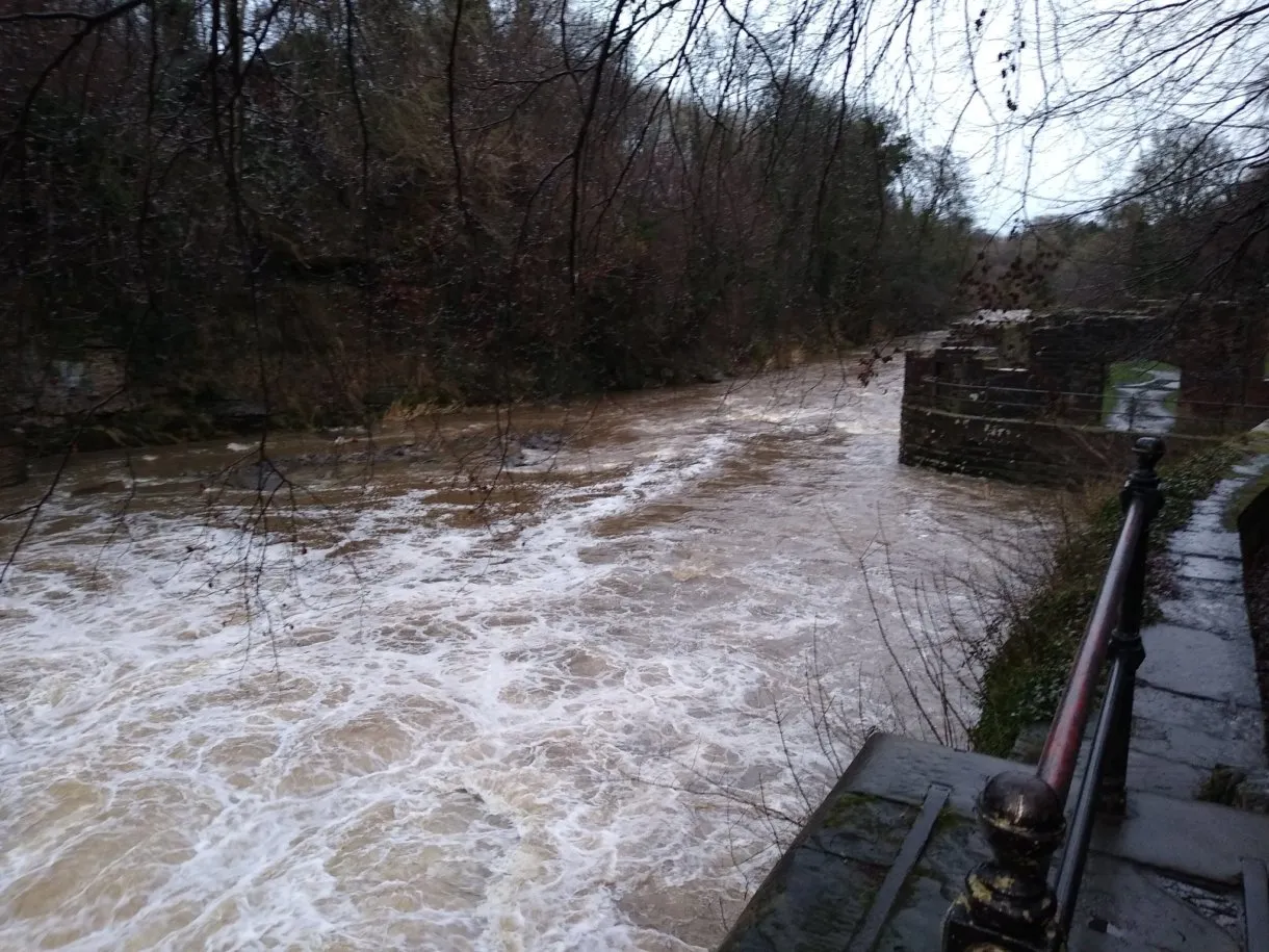
Further up, you come to the first weir. The water was really flowing and thundering along here - it was quite loud, and you see the water was quite churned up just below the weir.
You can just see the remains of one of the mills in the right of the pic above. It was quite a ruin, but the path takes you through the ruin, which is quite cool. The mill is just below the weir, and would have used the water power to drive its machinery. The weir would have been put in place to create a reservoir of water so that the mill could be powered at any time.

Its not a great pic, but at the far end of the weir you can see the fish ladder which allows fish to get upstream beyond the weir. This is quite important especially for salmon, of which we have a lot in Scotland. They are born upstream, and then spend the majority of their life at sea, and then return to the same river and area where they were born to respawn, after which they die. Hence its important for man-made obstacles like this to have some form of by-pass to allow fish to get to their spawning grounds.

I spotted this tree along the path, its been cut down now, but I just loved the root system that you can see coming from it - it begins to give you an idea of just how much roots are below the surface on a large tree.

There was also this carved tree at the side of the path, which was quite fun. Someone had been trying to make it look like a shark or a whale. Quite a nice feature on the path !

There was a second weir further up, and again you can see the effect the volume of water is having as there was a lot of debris washed down and being caught in the obstacles by the weir where the water was flowing quite fast.

One of the main things to see along the route is the 'Cramond Brig'. It was the old bridge that crossed the Almond providing the main route along the north west shore into Edinburgh. It is quite pretty and is only open to people on foot now, and appears to have been a toll at one point, which makes sense as it would have been a very key entrance to Edinburgh, and hence have generated a lot of income for whoever controlled the toll.


Although well built, the bridge is quite narrow (just over a car widths wide- or I probably should say cart - as that is what it would have been designed for). Further up from here you can see the new bridge that replaces it, which carries a 4 lane highway. Its not quite as pretty as the original !

The marker below was located on one side of the Cramond Brig, which is quite quirky. The brig has been worked into the National Cycle Network, with this part linking the route from the Fourth Road Bridge to Edinburgh City Centre.

At this end of the path there is also quite a nice steakhouse (maybe I'll have to plan my next walk along this route to take advantage of it !). Its in quite an interesting building as can be seen here with a large window running full height.

I quite enjoyed the walk up to the brig and back, which must have been around 3-4 miles in total. It allowed me to get some steps done, noting that I'd not done much over the holiday season, and was still feeling a little delicate after having celebrated a bit too much at new year. So I needed some fresh air to blow away the cob webs.
By the time I got back to the starting point, it was starting to get dark and the various towns and villages along the edge of the Firth of Fourth were being lit up for the evening.
All in all it was a very good walk, with nice scenery along the whole route, and I will definitely do it again.
