Greetings friends of HIVE / Saludos amigos de HIVE/

La ruta se llama ¨Ascenso del rio Chillar¨ y se trata de subir por el cauce de un rio con poco caudal de agua aunque por algunas zonas te puede llegar el agua por las rodillas.
Today I am here to tell you about an excursion that my girl and I took along a hiking trail in Nerja, province of Malaga, in the south of Spain.
The route is called ¨Ascenso del rio Chillar¨ and it is about going up the bed of a river with little water flow, although in some areas the water can reach your knees.

Comienzo del sendero Ubicación What3words
Tras aparcar el coche a las afueras del pueblo, llegamos a un solar de arena y graba rodeado de pequeñas montañas a los lados, aparentemente un paisaje bastante desértico y con un pequeño canal de agua que baja por un riachuelo. A partir de ahí comienza la aventura y la caminata hacía arriba.
After parking the car on the outskirts of the town, we arrive at a sand and gravel site surrounded by small mountains on the sides, apparently a fairly desert landscape with a small water channel that runs down a stream. From there the adventure begins and the walk up.


Leímos en internet que a los senderistas no experimentados aconsejan coger algún palo que encontremos en el camino para mas adelante cuando lleguemos a la parte mas húmeda tener siempre algo donde apoyarnos al caminar. Mi chica agarró uno y lo llevó todo el camino, en alguna ocasión le saco de algún problema, jejeje.
We read on the internet that inexperienced hikers are advised to take a stick that we find along the way so that later, when we reach the wettest part, we always have something to lean on when walking. My girl grabbed one and carried it all the way, on occasion I get her out of trouble, jejejeje.

Conforme íbamos subiendo por el cauce la vegetación se iba volviendo mas verde y el cauce del rio iba cogiendo mas fuerza. También leímos que aconsejaban llevar unos botines viejos para mojarlos o unos escarpines. Nosotros elegimos los escarpines porque teníamos unos viejos de cuando vamos a las playas donde hay chinos o piedras.
As we went up the riverbed, the vegetation was becoming greener and the riverbed was gaining strength. We also read that they advised to wear some old boots to get them wet or some booties. We chose the booties because we had some old ones from when we go to the beaches where there are Chinese or stones.

Llegó un momento en el que ya no podíamos caminar por otro sitio que no fuera el agua, siempre teniendo cuidado porque el fondo estaba lleno de piedras y es muy fácil doblarte un tobillo ya que conforme subía el nivel no veíamos absolutamente nada de donde pisábamos.
There came a time when we could no longer walk anywhere other than the water, always being careful because the bottom was full of stones and it is very easy to bend an ankle since as the level rose we could see absolutely nothing where we stepped on.

Throughout the tour you were finding small pools or ponds where the water covered something else, even if you stooped down a little it could bathe you completely. People took advantage of those places that were also larger and more spacious to sit, rest, eat or simply relax listening to the sound of the water flowing through the river.

We also found places where several tributaries joined that river and mini waterfalls and small water ledges were formed. The water was extremely cool and clear, we even drank from some of those water ledges even though they didn't recommend it.
The truth is that they were super nice places as well as quite humid, hehehe.
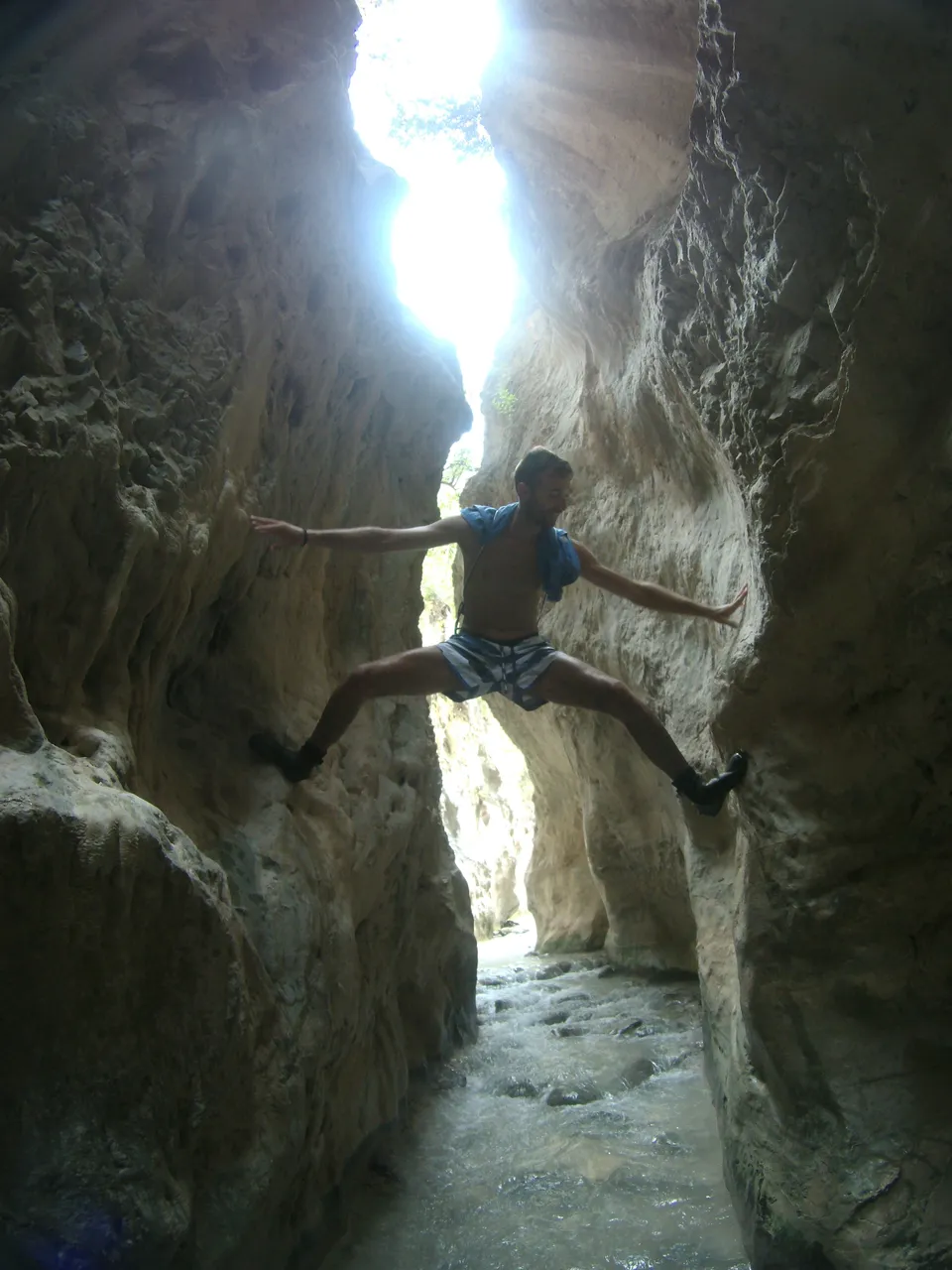
At last we arrive at one of the most anticipated and photographed places on this trail. A small canyon through which the water flows, barely 1.5 meters wide and about 15 or 20 meters high, where you can touch both sides with your hands. At first it gives a bit of claustrophobia to see you stuck there with no return since you can only go up or down and more knowing that you are going through the bed of a river, but we let ourselves go for the moment and we enjoyed it a lot. They are approximately 100 m.

Al llegar arriba del todo paramos para comer en una roca gigante donde pudimos tumbarnos y descansar para prepararnos para la bajada. A la vuelta nos paramos por el camino para hacernos algunas fotos ya que durante el ascenso te encuentras todo tipo de piedras y troncos que se han caido por las inclemencias del tiempo.
Upon reaching the top we stopped to eat on a giant rock where we could lie down and rest to prepare for the descent. On the way back we stop along the way to take some photos since during the ascent you find all kinds of stones and logs that have fallen due to inclement weather.

Por fin llegamos al coche de vuelta y nos pudimos cambiar, poner ropa seca y los zapatos ya que teníamos los pies totalmente arrugaods por llevar tanto tiempo en remojo, jejeje.
En total han sido 9 kilómetros que no son muchos pero se hacen duros al tener que ir caminando por dentro del cauce del rio prácticamente durante el 80% del trayecto.
We finally got back to the car and we were able to change, put on dry clothes and shoes since our feet were completely wrinkled from soaking for so long, hehehe.
In total there have been 9 kilometers that are not many but they are hard as you have to walk inside the riverbed practically during 80% of the journey.
¿Que os ha parecido esta ruta de senderismo?
¿What do you think of this hiking trail??


[//]:# (!pinmapple 36.76816 lat -3.87795 long Rio Chillar (Malaga) d3scr)