A while ago I wrote about my visit to the most eastern point in Taiwan. Today we're going to the most northern point on Taiwan mainland called Fugui Cape.

Like the last location, Fugui Cape also has a lighthouse. This black and white octangal lighthouse was built in 1897 when Taiwan was under Japanese rule, and was the first of many lighthouses built by the Japanese in Taiwan.
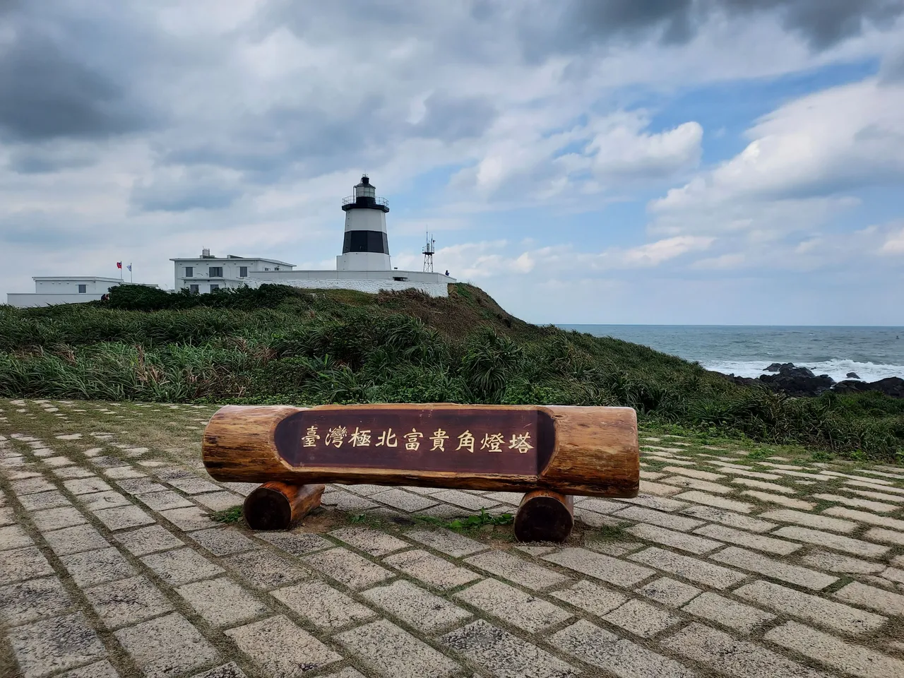

To be honest, there wasn't much to do around this area, other than checking-in at the most northernly tip in Taiwan. We lingered around a little while, batting with the wind, took my mandatory selfie, then headed off to our next stop Heping Island a little further south.


Heping Island is a little island located on the north east of Taiwan. It's only 75 meters away from the mainland and is connected by the Heping Bridge. The island is of historical significance because it was the first landing point for the westerners when they first arrived in the 17th century. The other thing that Heping Island is famous for is its landscape. That is best seen at the Heping Island Park, a park that preserves and promotes the natural geological park landscape here.

My friends and I arrived about an hour before the park was due to close, so didn't have as much time as we would have liked to walk around and admire the landscape. I hate it when we don't plan well enough and have to rush through things. For the limited time we had, we had to choose carefully on where we went. The zig zag bridge looked fun, I'd love to run across it and explore what's on the other side. Sadly, my friends didn't share my passion.

Here's the alternative path, looks equally exciting walking alongside the cliff.

The weather in this part of the world has eroded the rocks and landscape into interesting shapes. According to the signs dotted around, the stumps of rocks are called pedestal rocks. I think they look more like mushrooms!!!

And these square shape rock erosions are called chessboard rocks - makes perfect sense.

Some sections of the path were very near to the rocks and I got a very close look at the erosion effect it had on the landscape. The strong waves also bought a lot of debris back on shore.

A bit further along, we got to a viewpoint. Of course, I walked all the way to the edge beyond the pavilion, but I think this image gives a much nicer view of the surroundings.

After a quick wizz around the geological park, it was time for us to leave. Our final stop of the day was back across the Heping Bridge to Keelung. Keelung is Taiwan's second largest port, and the port, along with the town is located about 4 km away. However, Keelung is better known for the older part of the town which is just on the other end of the Heping Bridge.
This is it... these colourful houses along the marina. It's the most famous landmark in Keelung and a very popular one for Taiwan as well. I've seen them on websites before, and have always wanted to visit Keelung to see for myself. The other reason I wanted to visit Keelung, is because one of my oldest friend on the chain 


