
Hello everyone!
I have featured a lot of hiking spots here in Cebu and felt I had already covered most of them, especially those famous ones, but I was so wrong! The lesson I got from this hike is just to be always open to invites even if you feel you've already been to a certain place. There's always something new to experience out there.

This hike was from a gloomy Sunday morning two weeks ago and was before I climbed Mt. Mandalagan on an injured foot. I was invited by my usual hike buddies to hike on a Sunday regardless of what the weather would be. I anticipated a rainy morning because it has been raining most of the time here in Cebu for the past month or so. I can say this was a pre-climb, but it was a chill one that my friends couldn't even consider a preparation. We just agreed to meet at Guadalupe Church and decide where to hike after our breakfast.

The City View
I thought we would just go with the usual route to Napo and then Mt. Babag, but I was wrong when we turned into a different alley from Guadalupe Church. It was 7:00 AM, but the sky was dark and it felt like it could rain anytime. We realized we made a wrong turn when one of the residents in the area asked us where we were going. James, our organizer and guide for this hike, told her that we would be going to Baksan. She told us that the right alley was the next one from the main road.

From that small alley, it became a winding and maze-like footpath along residential areas and apartments. I can't remember now the exact path with its twists and turns. I just felt that we are constantly gaining elevation because I was always catching my breath. There was no clear view because we were still surrounded by buildings and houses. When we got out to a small road at the upper portion of the hill, I noticed that we have covered a long distance in a short period. That must be the reason why I was catching my breath.

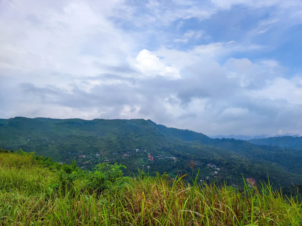
Once we were past the houses, we were slowly approaching Monterazzas de Cebu because we were able to see the national grid transmission line tower. The terrain was covered by cogon grass, an indicator that we are near the famous subdivision in Cebu.


I was amazed by the view even if the weather was not so good. This is what I love about Cebu. You can have a good city view even if the hike is just a few kilometers from the city center.


Just a few minutes of walking and we reached the first stop: the transmission line tower. It became sort of a landmark for hikers in Cebu. There's even a trail called "7 Towers" because you'll pass by seven transmission line towers along the trail. That would probably take 12 to 13 hours of walking. Anyway, we rested for a bit below the tower. We were all panting because we didn't anticipate our pace to be that fast. I guess everyone was too excited.


I couldn't help but take a lot of photos. I took advantage of the rest because it's difficult to take photos when your hiking buddies are fast walkers.


After a few minutes of rest, we continue walking down a dirt road. I took photos as we were going further away from the city and the transmission lines tower. We would be venturing into the other side of the hill that's facing the mountains of central Cebu. That was the part of the trail that I didn't know exists.


The Mountain View
Before entirely going to the other side of the hill, we passed by a house at the top of the hill that's farming moringa, lemon grass, and papaya. We joked that if there's a chicken roaming around, the recipe for a chicken tinola (soup) would be complete. I wondered how it would be to live in that part of the city. I mean it's still part of the city, but seemed to be completely different from the life below.


As we were almost at the edge of Monterazza's property, I was amazed by the contrast. At the east is the city view and the mountain view is at the west. As I stood there, I was in awe at how small the area of Cebu was that I was able to explore. It's just so interesting to note I it was my first time to be there considering that it's just facing the city.


Most of the time I was just taking pictures using my phone while we were walking. I didn't mind if I got a good shot, but these photos turned out to be so much better than I anticipated. I guess you really can't go wrong with mountain views. I personally liked this part of the trail. I mean look at these photos:


We passed by this big tree, which I believed to be a local species of breadfruit, along the trail. They say it's an indicator that we were near to the store that would be our resting area before deciding which trail to pursue.
As we reached the store, there were santol or cotton fruits for sale. We bought a few just to satisfy the cravings, but those cotton fruits turned out to be so sour. It was the sourest santol I've tried so far. I believe the local variety is small and sour compared to the Bangkok variety which is big and sweet. We didn't complain though. Some people love the sourness of santol, especially with vinegar, salt, and chilies.
After our rest at the store, we continued our hike because it started to drizzle and we wanted to reach the southern part of the trail with an interesting name. Good thing I bought an umbrella, so I didn't mind the rain. It didn't last long though.

I was really amazed by the trail. It was not so difficult, but the view is magnificent. Just like the unpredictable weather, one moment the view is like this:

And the next it would be like this:

We continued walking until we reached the south side of the trail that they call "Olok-Olok". It's an interesting local name that I would rather not translate it.


I just want to say that if you know, you know. Please don't mention anything in the comments. 😅 I asked my friends, especially those who are really familiar with the trail, about the origin of the name, but they said it is most likely named by the hikers.
A few moments later, we reached our destination which is also overlooking the city, but on the south side.
Back to the City View
We had some trail snacks, had some interesting conversations, and then took some photos before traversing the downhill part of the trail and going back to the city via Tisa. I guess I'll just share some photos at this point. I really hate the downhill part of any trail. Coupled with wet rocks or muddy trails, I dread going down because I can feel I would slip anytime.

The newly opened Cebu-Cordova Link Expressway (CCLEX) or the third bridge between the mainland Cebu and Mactan island can be seen in the photo below:

More photos from the hike:


After about 4 hours of hike, we reached Barangay Tisa which is famous for its siomai. Of course, we didn't miss the siomai sa Tisa as our lunch. To cap off the hike, you eat a lot so the calories you burned from the hike will be replenished, but since you at least 5 pieces of puso (hanging rice), you ended up taking more calories than you lost. I mean that's how it works, right? Right!?
I guess that's all for this post. See you at the next one!

Kim Ybañez
Welcome to Kim's small corner in Hive. He is a chemical engineer by profession, but a blogger by passion. He is a wanderlust and an adventure seeker. Join his quests as he visits secluded destinations, climbs mountains, tries new and exotic dishes, and explores his country (The Philippines). He's also a trying hard photographer so stay tuned as he shares his photos and his thought process while creating them.
If you like his content, don't forget to upvote and leave a comment to show some love. You can also reblog if you want to. Also, don't forget to follow him to be updated with his latest posts.