¡Hola, amigos aventureros! Hoy viajamos a la freguesia de Conceição para disfrutar de uno de los senderos más lindos que Portugal tiene para ofrecer. Esta caminata tiene una extensión de apenas 4 km y una duración de 2 horas. Sin embargo, el corto tiempo se compensa con el hermoso paisaje y la neblina misteriosa de la zona. Mi misión hoy es llegar a la Cruz Templaria, que marca el final del sendero.🚙🌻
Hello fellow adventurers! Today we travel to the parish of "da Conceição" to enjoy one of the most beautiful trails that Portugal has to offer. This hike is only 4km long and takes about 2 hours, but the short time is more than compensated for by the beautiful scenery and mysterious mist of the local area. My mission is to reach the "Templar Cross," which is the end of the trail.🌱🛣️

Coordinates:38.679033, -27.212769🌏🧭 / Coordinadas: 38.679033, -27.212769📍🌏

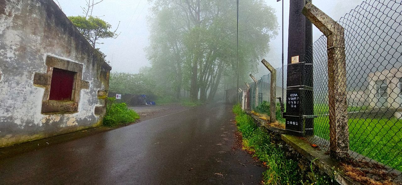
Te dejo las coordenadas del sendero. Está claramente señalizado, por lo tanto es imposible perderte, pero hay un problema... Los días de lluvia es demasiado difícil porque el terreno se pone muy fangoso y te resbalas, incluso usando cualquier tipo de botas. Hoy fue el caso; estaba lloviendo y no pude sacar mi Canon, lo que se redujo a tomar unas fotos con mi teléfono y mi DJI.🌏📍
I'm giving you the coordinates for the trail; it's clearly marked, so it's impossible to get lost, but there's a problem... On rainy days it's too difficult because the terrain gets very muddy and you slip even wearing any kind of boots. Today was one of those days; it was raining and I couldn't get my Canon out, so I ended up taking some photos with my phone and my DJI.🌱🌺

Subscribe to the channel, video coming soon from a volcanic island🧭🏞️ / Suscribete al canal proximamente video en una isla volcanica🚩📍


Trail characteristics🧭🏞️ / Caracteristicas del sendero🚩📍


=================================================================================
En:
=================================================================================
Es:
=================================================================================

Which mill routes?🧭🏞️ / Por que rutas de los molinos?🚩📍


El nombre del sendero hace alusión al río, aprovechando que viene del pico Morião a más de 500 metros de altura. Como mencionaba, me encuentro en una zona casi tropical que tiene un ecosistema y clima bastante diferente al Portugal continental, donde llueve menos. Los lugareños aprovecharon este recurso para construir molinos de agua.🚙🌻
The name of the trail alludes to the river, taking advantage of the fact that it comes from the peak: Morião at more than 500 meters high, as I mentioned, it is located in an almost tropical area that has an ecosystem and climate quite different from mainland Portugal where it rains less, the locals took advantage of this resource to build water mills,🌺🌏


Llegó un momento donde paró de lover una media hora; sin embargo, ¡la neblina nunca se fue! Me acompañó todo el recorrido, lo que añadió un toque de misterio y dificultad a la caminata. No tenía campo de visión a más de 5 metros, por lo tanto era algo arriesgado salir de las señalizaciones del sendero. Sé que voy hacia una montaña, pero no tengo percepción de cuánto puedo demorar por causa de la densa neblina.🌻🚙
There came a point where it stopped raining for about half an hour, however the fog never left! It accompanied me the entire way, which added a touch of mystery and difficulty to the walk. I didn't have a field of vision beyond 5 meters, so it was risky to leave the marked trails. I know I'm heading towards a mountain, but I have no sense of how long it might take because of the dense fog.🏞️🛣️
Let's complete the route🧭🏞️ / Completemos la ruta🚩📍


Endemic forest of the Azores🌏🧭 / Bosque endemico de Açores📍🌏

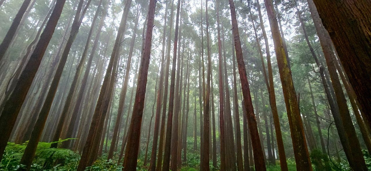
El bosque me protegió un poco de las condiciones climáticas, lo que me subió el ánimo, ¡ya que hacer senderos con lluvia es deprimente! Si observan bien el bosque, destacan los cedros gigantes, dando un toque jurásico y que fue el principal motivo de visitar la isla. Este ecosistema se llama bosque de laurisilva. 🌏🌺
The forest offered me some protection from the weather, which cheered me up since hiking in the rain is depressing! If you look closely at the forest, where the giant cedars stand out, giving it a Jurassic feel—which was the main reason for visiting the island—this ecosystem is called: (laurel forests)📍🌱


Llegamos al área del acueducto, construido en 1886 para suministrar agua a las personas de las aldeas de los alrededores, y aquí es cuando el sendero comienza a intensificarse porque a partir de ahora debemos subir la montaña. Cabe resaltar que estamos a 2 km de terminar.😏🙇🏻♀️
We arrived at the aqueduct area, built in 1886 to supply water to the people of the surrounding villages, and this is when the trail begins to intensify because from now on we must climb the mountain; it should be noted that we are 2km from finishing.🛣️🗺️📸


Mission completed🌏🧭 / Mision completada📍🌏
THANKS FOR READING ME (PHOTOS AND VIDEOS OF MY PROPERTY) / GRACIAS POR LEERME FOTOS Y VIDEOS DE MI PROPIEDAD🙂🧠🦾👍


We invite you to visit our community/ te invitamos a visitar nuestra comunidad📸🧭
https://www.reddit.com/r/Amazingnaturehive/

