
The sun was shining this past Saturday. We've been indoors for a bit because of the Arctic blast that blanketed Northeast USA. We decided to take a scenic ride, a picture-taking ride. My husband has a leg that's healing from a spontaneous fracture, so a walking tour was out of the question.
We're fortunate that we live in a beautiful area, the North Shore of Long Island, New York. This area hugs multiple bays and the Long Island Sound. It is also full of history. The route that took us East of where we live, Route 25A, was originally used by indigenous peoples. Here is an excerpt from a 1997 New York Times article:
Long before the white man set foot on American soil, it was an Indian trail that meandered along the north shore of Long Island. Later, it served as the path connecting all the shoreline settlements of the first colonists and as one of three roads laid out at the request of the Colonial Government in 1724. During the Revolutionary War, it was used by spies who were supplying General Washington with information about the British troops.
Map of 25A (The Red Line Curving Along the North Shore
Chinissai. public domain

On the map you can see two towns noted: Centerport and Northport. These are the communities where most of the images in this blog were captured. The bird at the top of the post was sitting on a pole that supported a Northport pier. The bird was looking at me, as you can see. Here is another shot of the same bird, gazing out to sea, probably hunting for its next meal. It certainly looks well fed, doesn't it?

On the way to Northport, we passed through another historic town, Huntington. We pulled over so I could get a shot of the historic church there, St. John's Episcopal Church. The sign out front states that the church was founded in 1745. The colonies were still part of England at the time. Two wars were yet to be fought on our soil before independence: The French and Indian War (part of the larger Seven Years War), and the Revolutionary War.
This church is a quite active part of the community. Here's the sign out front that announces times for services. The Episcopal Church in Colonial America was an offshoot of Anglicanism--the state religion in England.

Religion played a large role in the settlement of the colonies. As a matter of fact, I am descended (paternal forebears) from religious dissenters who settled in the Northeast in the earliest days of the colonies. These people were not Anglicans, or Episcopalians. There were serious Protestants, Puritans and Huguenots. When I travel along Route 25A I have a personal sense of history, because of my family's connection to the past.

You can see by the snow and ice in my pictures that temperatures were still below freezing but the sun was glorious and made brief walks outside quite tolerable.
Next to the church was the Historical Society. Here there was a cemetery (which I did not get to explore...I'll have to go back) and a memorial to the Civil War dead. Here is a stone plaque that was in front of the building.

Here is the full monument, with the statue of a Union soldier (fought with the army for the North, which won the war), as he would have appeared in uniform. More than 600,000 soldiers died in that war (both sides) and more soldiers from New York died than from any other state in the country. If you follow this link you can find a map that shows the casualties from each state.

Another personal aside: My husband's Great-Great grandfather fought in the Civil War. He was an Irish immigrant who must have been caught up in the mass conscription. After the war he returned to Ireland. Two generations later my husband's father repeated the migration. He was conscripted into WW II. Twenty-six years later, my husband was conscripted into the Vietnam War.
My husband's family is either very unlucky (they were all drafted), or very lucky (they all survived).
As interesting as the stories of St. John's church and the Historical Society monument are, my scenic ride on Saturday was more about nature. I wanted to see the shore, and the wildlife. That part of my ride kicked in when we reached Centerport. There we pulled over to take some pictures of a small pond that was very much alive with birds.
We saw geese that literally covered the surface of the pond.
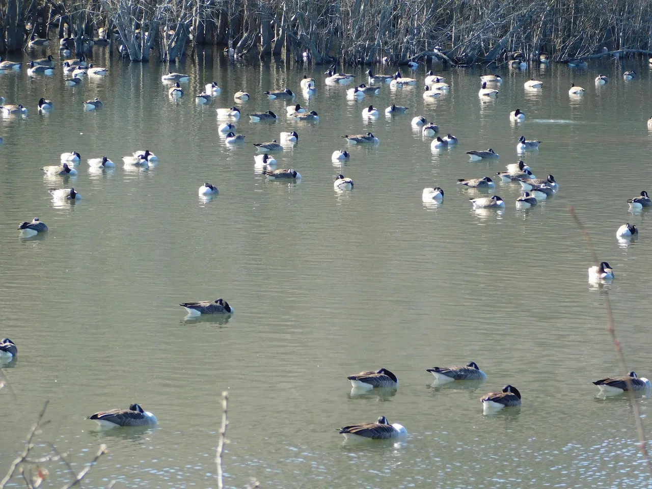
Here is another shot of the geese

As we looked closer we realized that pond was home also to ducks. You can see one intrepid duck heading toward the geese in the next photo. There is also a solitary swan in the foreground.

Here is another shot of the swan, up close. In this picture the swan occupies the frame by itself, which is unusual in my experience. I'm accustomed to seeing swans in pairs. I looked it up, and read that a solitary swan such as this one might be from last year's brood and may not be old enough to mate yet.

As I was taking pictures of this pond, my daughter looked across the road and saw a much larger body of water, from which this one may have been derived. This larger body of water had a name, Mill Lake. There are many Mill Ponds/Lakes on Long Island. As I registered the existence of yet another one, I thought milling must have been a popular activity at one time. Sure enough, I discovered that there were more windmills on Long Island at one time than there were in any other place in the country.
Here is a shot that shows an icy path running along Mill Lake, and icy water in the distance.
I found a map copied (on Wikimedia) from an old book that shows both the little pond and Mill Lake in Centerport. Centerport Harbor and Northport Harbor ultimately lead to the Long Island Sound, which eventually leads to the Atlantic Ocean.

E. Belcher-Publisher Hyde. Public domain

Here is another shot of Centerport Lake and the distant shore.

As you can see from the map, our drive to Northport was just down the road from Centerport. The town was quite lively. Northport attracts a lot of tourists. It also apparently attracts commercial shell fishers. I got a shot of what seems to be a small fishing trawler. You can see a raft in front of it with what appear to be shell fish cages.
Here is a shot of the shore with more cages piled up on it.


Here is a shot of a Northport pier. There seems to be a dredger in the distance. Apparently there is harbor dredging in Huntington, Northport, and Centerport harbors to move sand around and make the harbors more navigable.
You can see more shell fish traps piled up on the pier.

I've looked at the flood maps for this area and it seems that the very place we were standing in Northport has a high flood risk. Yet, there were lovely homes right there, hanging over the water. We looked down on one that had constructed a deck with lounge chairs that looked out across the harbor.

As I walked along the pier, I glanced down and saw a small fishing boat tied up to a piling. If this boat is used by a commercial seashell fisher, it must be a really small-time operation.

We had been out a couple of hours when we decided to go home. How to end such a lovely excursion? Stop at the famous Marios for pizza.
Except for the gas used and the pizza, we had a lovely time and it didn't cost us a penny. The North Shore of Long Island is surely a gem. I recommend a visit if you ever get the chance.
Except where noted, the photos were shot by me, using a Nikon Coolpix 500 camera.