Bear Hill Preserve on the Shawangunk Ridge, in New York State. Image credit: JulianCotton on Wikimedia Commons. Used under a Creative Commons Attribution-Share Alike 4.0 International license.
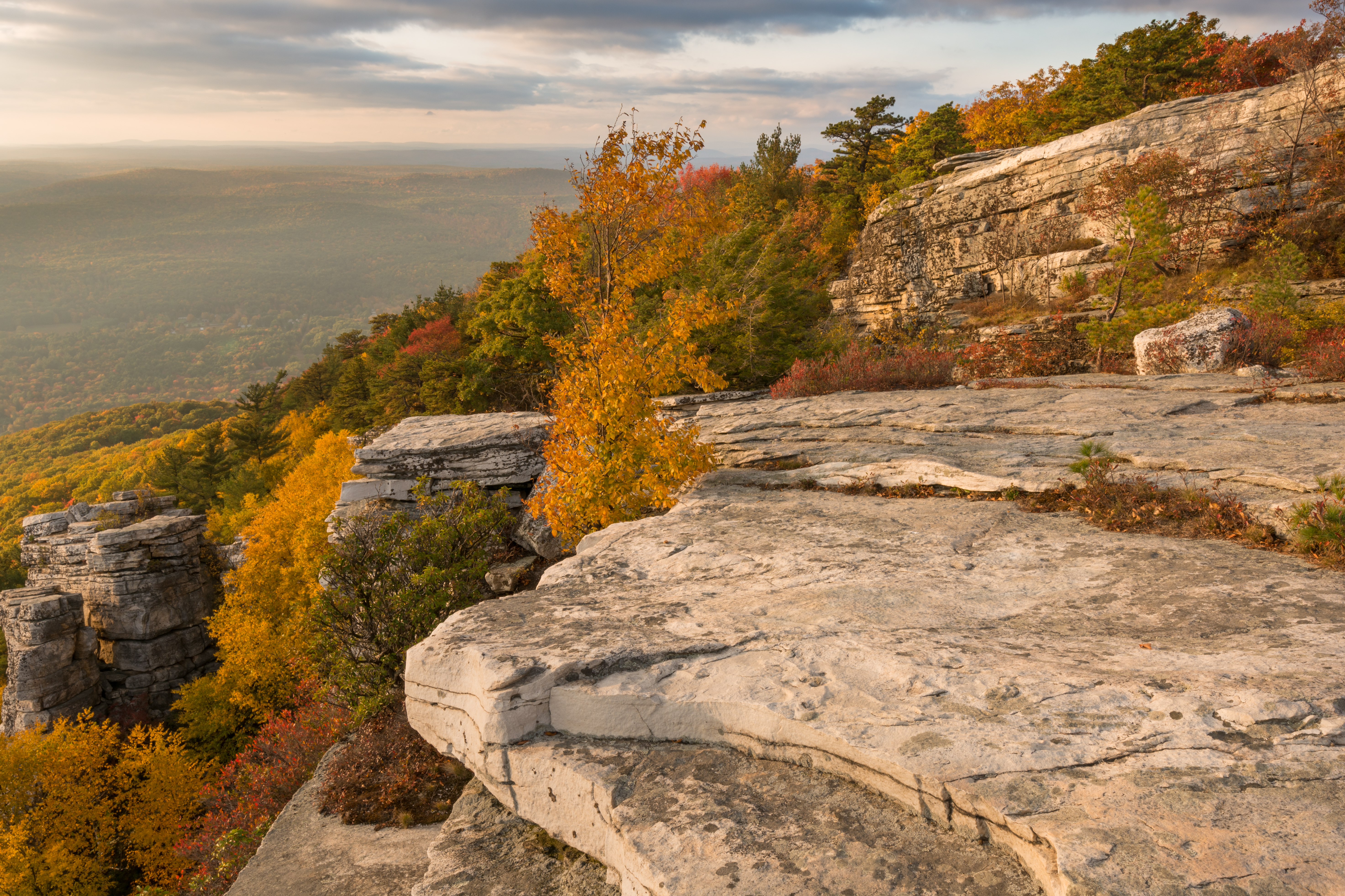
For those who have never visited the mountain regions of New York State, this pictorial will be an eye-opener. Most people have heard of the Sierra Nevada in California, highest point 14,505 feet, and the Rockies in Colorado, elevation over 14,000 feet. Most have heard of the Great Smokey Mountains, elevation 6,643 at the highest point. The mountains of New York State may not reach as high as these noble ranges, but they tell the story of the states' geological past. Shawangunk Ridge, about 2,240 feet, for example, in the picture above, soars above the surrounding landscape because of its quartz conglomerate composition. The conglomerate is made up of mostly quartz, some silica and a small amount of iron. It took millions of years to form. This durable rock formation resists erosion and allows the mountain to carve sheer cliffs in wooded landscape. Below the cliff, the softer siltstone and siliceous sandstone are more susceptible to erosion.
Castle Point in the Shawangunk Mountains. Image Credit: Mwanner at English Wikipedia. Used under a Creative Commons Attribution-Share Alike 3.0 International license.

*The Palisades that rise up along the sides of the Hudson River, in New York. Image credit: Salim Virji, used under a Creative Commons 2.0 Generic license. Wikimedia Commons. *

The rock formation of the Palisades along the Hudson River in New York, offer a geological map for the glacial events that helped to shape the cliffs. At the summit, striations may be seen that reveal the movement of glaciers. The glaciers carried along debris, that cut into the sides of the cliffs. The palisades themselves had formed much earlier, more than 120,000 millions ago, when the continents split apart.*
An artist's rendering of the Palisades at Sneden's Landing, on the lower Hudson River. Painting by Robert Knox Sneden, 1858. Public domain. Wikimedia.

An aerial view of the Hudson River. Image credit: Jessica Spengeler from Brighton, United Kingdom. Picture is used under a Creative Commons 2.0 generic license.

The Hudson River was formed over millions of years in a series of events that culminated in the retreat of the Wisconsin Ice Sheet, the last glacial event of the last Ice Age. The melting of the glacier filled vast lakes, one of them Lake Hudson. As the glacier retreated further, water from Lake Hudson was released and poured through the Hudson Channel to the Atlantic Ocean. It was during this glacial retreat that the islands of New York City were formed. It is believed that the River reached its present level about 6,000 years ago.
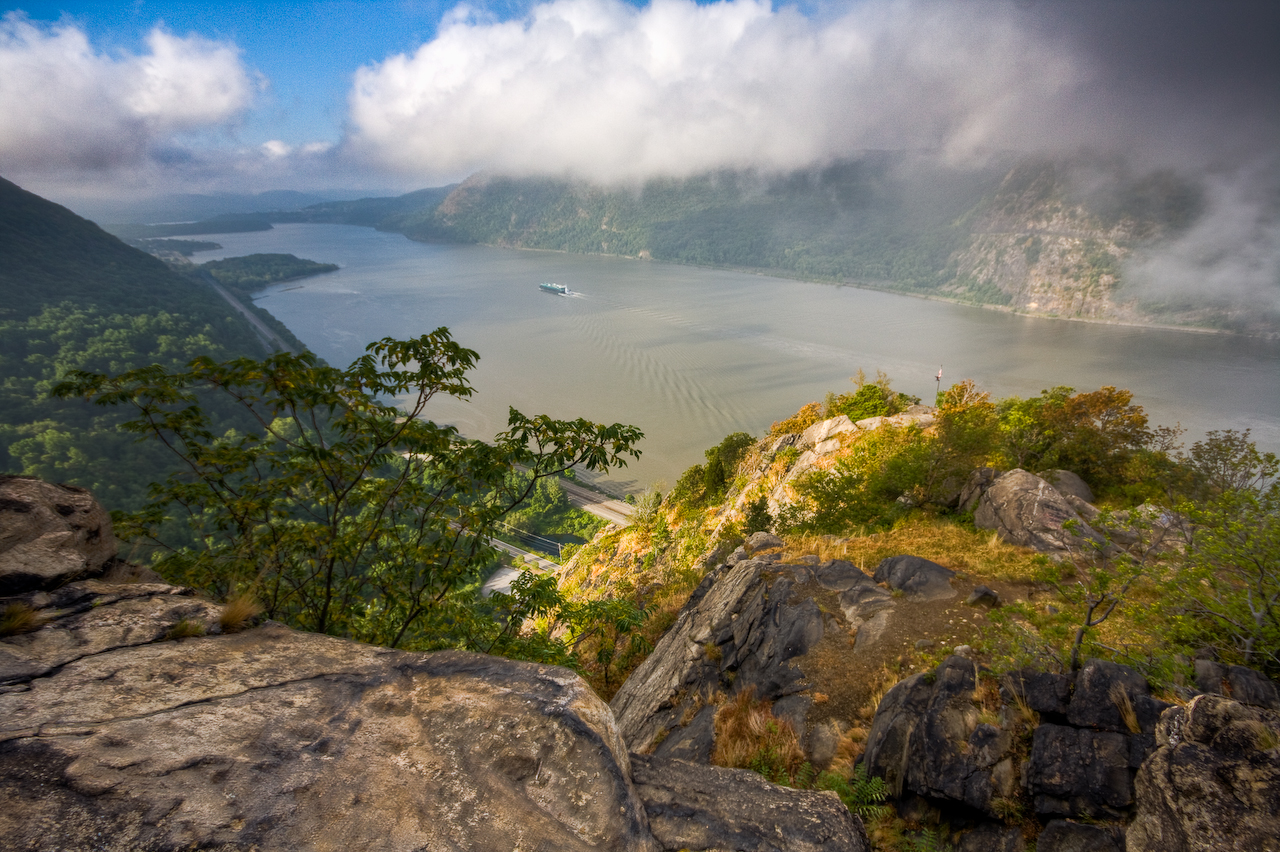
A view of the Hudson River from the Hudson Highlands. Image credit: Jeffrey Pang from Madison, NJ, USA. Picture used under a Creative Commons 2.0 Generic license.
Shawangunk Ridge visible from Skytop cliff tower near near Mohonk Mountain. The picture credit: Jarek Tuszynski, on Wikimedia Commons. Used under a Creative Commons Attribution-Share Alike 3.0 International license.

Locally, the Shawangunk Mountains are called the Gunks. The Shawangunks are actually part of the long Appalachian chain that runs north to south in eastern United States. In New Jersey the chain is called the Kittatinny Mountains. In Pennsylvania the chain is called the Blue Mountain. Geologists believe the Appalachians were formed by tectonic collisions. Before these collisions, the Appalachian area was similar to the Atlantic coastal plain today. Colliding plates put pressure on the land and created the mountains. This may have happened as long as 480 million years ago.