This is the second post from my 3 part post series on my exploration flight around the Spring Mountains and Red Rock Canyon area in the wilderness of Nevada, west of Las Vegas.
Continued from Part 1....
After passing through the small pass between Potosi Mountain and the sandstone cliffs to the south or Red Rock Canyon I angled towards the eastern side of the mountain. The wind was blowing pretty hard at this time, and I noticed it especially as I was coming through the pass due to the venturi effect caused by funneling of air into the canyon space.
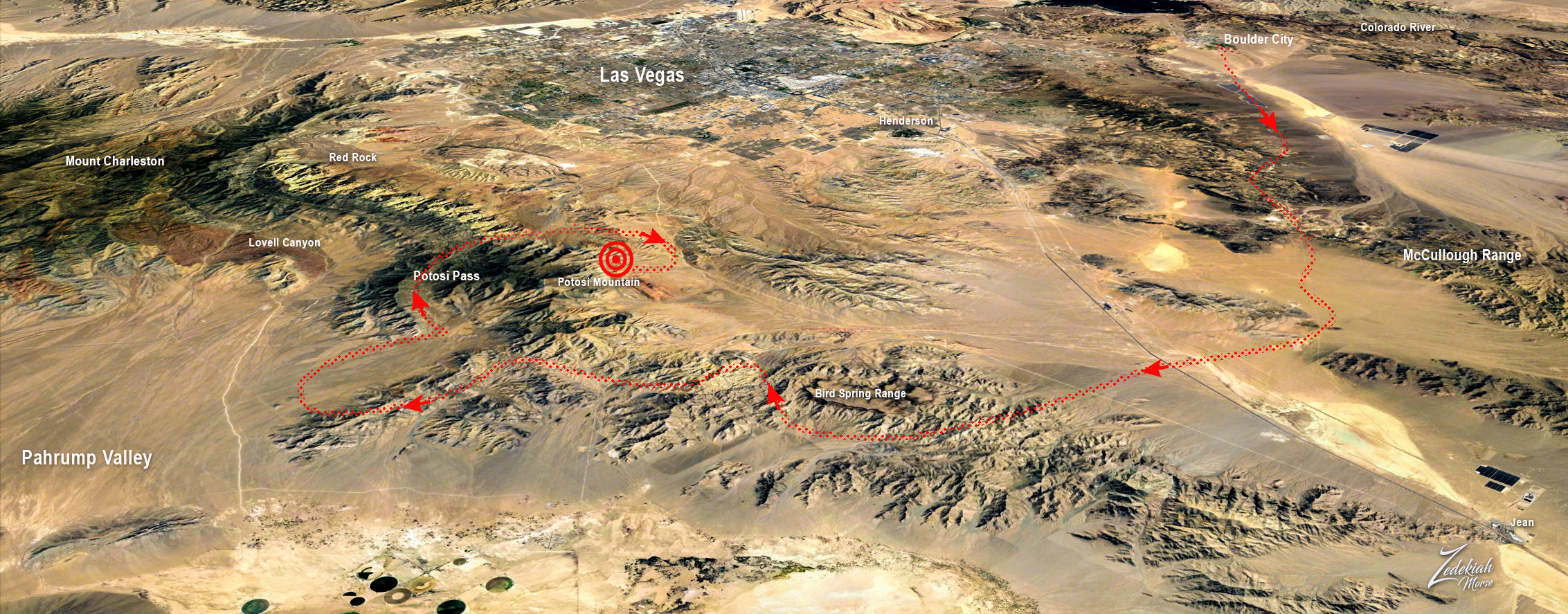
But when I arrived on the eastern side of Potosi Mountain it started to get really rough and I was getting bounced around a lot! The following map shows the flight location of this part of the story, this all happened where the circle target is next to Potosi Mountain.
I had flown into the leeward side of the prevailing winds over the mountain and the winds were creating horizontal rollers, also known as Mountain Waves or Rotor Turbulence. In the following illustrations from Bold Method you can see how these are formed but to get a clear picture go to their article about the effect here.
In this first illustration notice the lenticular clouds on top of the mountain?
Now take a look at the image below I captured from the wingtip camera mounted on my right wing. Notice how the leticular cloud has created a cloud cap on top of Potosi Mountain?
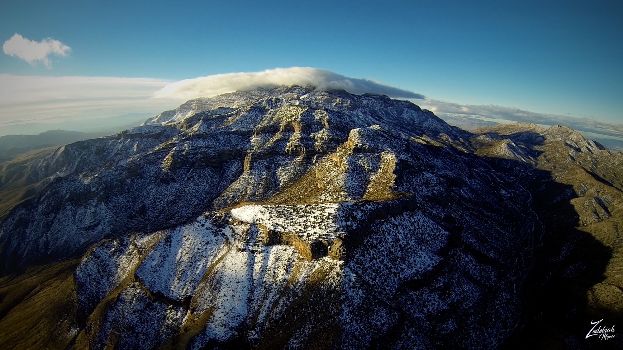
I had just passed through that pass on the right side of the image and was now on the eastern side of Potosi Mountain, and this put me squarely in the rotor zone. Take a look at the image below to get a clear picture of the wind effect.
These rotor systems are basically horizontal tornadoes and can seriously disrupt your day! If you are not paying attention to what is happening and allow yourself to get caught in the downward wind draft of the rotor it can literally push the airplane into the ground or the side of the mountain. Either way it can be disastrous!
To give you an example of what this is like I create a short film about my overall experience that day flying the route around the mountain and getting brushed by a rotor system. Take a look at this film and I hope you enjoy!
https://vimeo.com/203612363
This is the end of Part 2 of this 3 part series on my aerial exploration of the area around Potosi Mountain and Red Rock Canyon. Stay tuned for Part 3
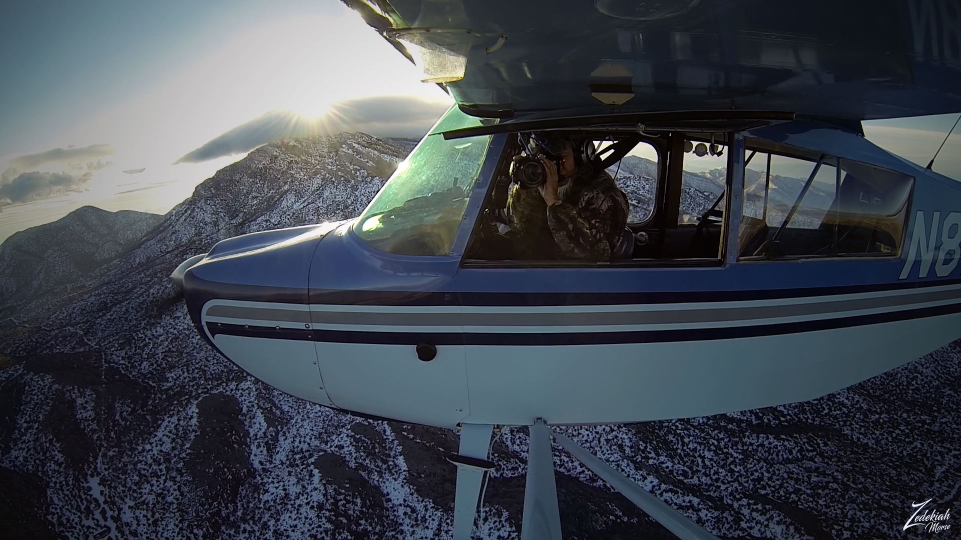
I lensed these images at different times while exploring this awe-inspiring wilderness area for my ongoing project, "Where Eagles Fly".
About The Project
Where Eagles Fly - The American Wilderness Expedition is my personal mission to introduce people to these amazing locations that surround us. I am piloting a bush plane while exploring and filming throughout the remote back-country areas of North America to raise awareness of the 47% of the USA and 90% of Canada that remain unpopulated wilderness.
About The Author
My name is Zedekiah Morse and I'm a Bush Pilot, Photographer, Explorer and Filmmaker. I live in the Rocky Mountains and devote my time and resources to exploring as much of the world as I can by air. If you wish to watch a short film detailing how I do my work and this project, go here.
If you like what you see here upvote and resteemit so that others may experience these wondrous places.
And if you'd like these images to be part of your feed, follow me.
Thanks for your support and Yehaw!!