

Hola querido hiver.
Si hay algo que me gusta de la comunidad Worldmappin es que no necesito preparar las maletas para compartir en ella. Me encanta ponerme el sombrero de guía turística de la ciudad en la que vivo. De hecho, lo disfruto muchísimo porque por una parte soy una enamorada de ella y por otra siempre descubro y aprendo algo nuevo cuando preparo este tipo de publicaciones.
En esta ocasión apenas me moví cuatro kilómetros desde mi casa. Mi idea era visitar el Centro de Historias de Zaragoza para ver un par de exposiciones y aproveché para pasear a la hora del atardecer antes de dirigirme hacia mi destino.

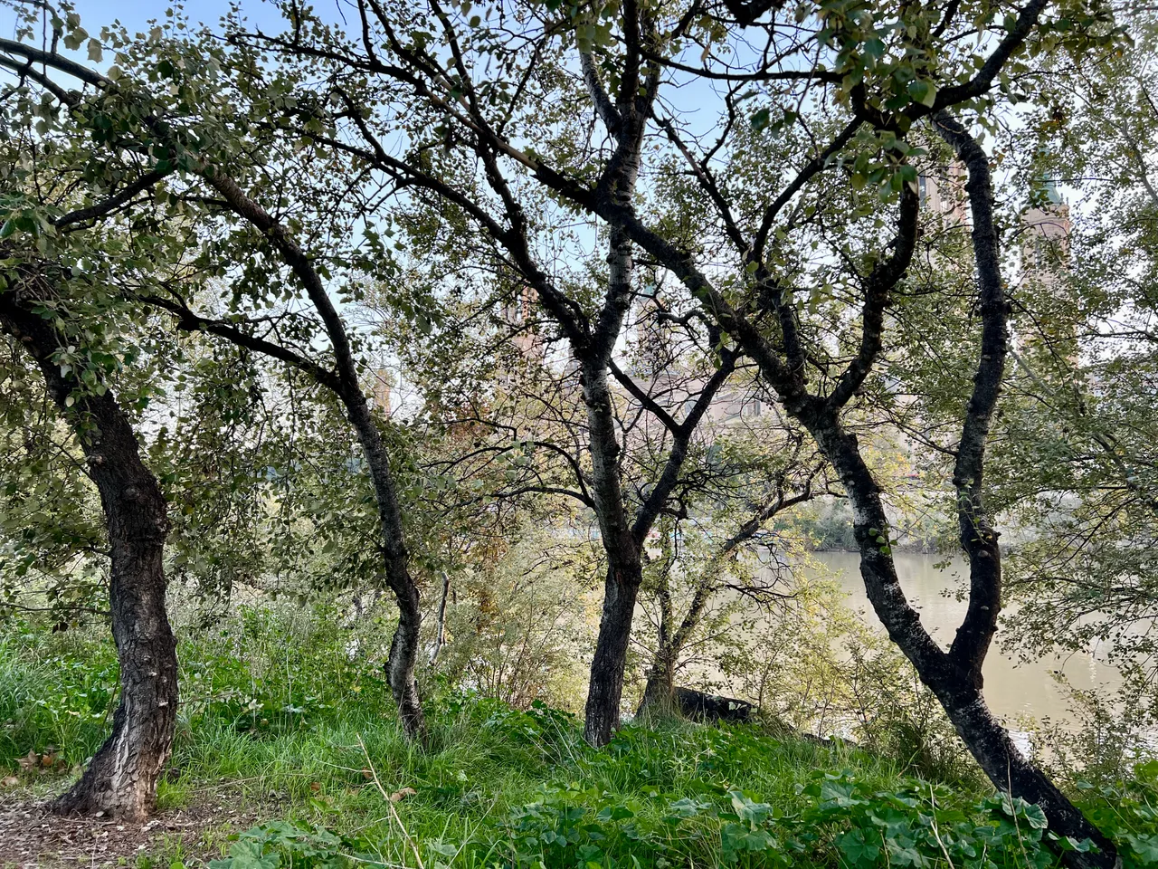
Hacía tiempo que quería recorrer con tranquilidad la parte del Camino Natural del Ebro que atraviesa Zaragoza. Este espacio fue recuperado gracias a la celebración de la Exposición Internacional del Agua y ahora son muchos los zaragozanos que lo disfrutan. También es un punto de interés turístico por las increíbles vistas que ofrece de la Basílica del Pilar. ¿Intuyes su silueta entre los árboles?


La margen derecha del río es un parque lineal entre los puentes de Santiago y de Piedra. Es frecuente encontrarse por aquí con personas paseando o corriendo, pero si te acercas al agua lo más seguro es que haya algún pescador esperando su premio.


Si nos atenemos al camino de baldosas como si Dorothy en El Mago del Oz y miramos hacia nuestra derecha de vez en cuando encontraremos las vistas más conocidas y de las más fotografiadas de la ciudad.


Las propias ramas de los árboles enmarcan las fotografías. Una se queda tan embelesada que sin darte cuentas llegas al puente de Piedra. Normalmente los turistas se hacen selfies con el Pilar de fondo desde ahí arriba. En mi caso no me desvié del camino y pasé por debajo del puente.


Muchos se piensan que es un puente romano, pero no lo es. Su origen es del siglo XV y ha sufrido destrucciones parciales por riadas y guerras, siendo reconstruido varias veces. En este tramo desaparece la vegetación y se puede alcanzar el agua. Cuando el nivel del río sube queda inundado y no se puede pasar.


Como los coches circulan por arriba el sonido se amortigua y si buscas calma mental sabes que has llegado a un lugar idóneo para conseguirla. De hecho, durante mi paseo había varias personas sentadas en las piedras de la orilla, con sus ojos cerrados, disfrutando de su momento de paz. Les habría imitado pero debía seguir si quería que me diera tiempo a terminar la ruta que me había planificado antes de que anocheciera. Regresaré.


Conforme me alejaba el sol se ponía exactamente detrás del Pilar. Nos acercamos al puente que se conoce como "de Hierro" pero que en realidad se llama puente de Nuestra Señora del Pilar. Incluso muchos zaragozanos lo desconocen.


En esta última parte del camino la pendiente sube, la orilla se aleja un poco de la senda y los árboles crecen en altura y grosor de tronco. En verano debe ser un sitio perfecto para mitigar el calor.


El puente de Hierro original de finales del siglo XIX es la actual zona central peatonal. Los ramales laterales por los que circulan los vehículos se añadieron a finales del siglo XX. La última vez que hubo que pintarlo para protegerlo de la corrosión el ayuntamiento hizo una votación popular para elegir los colores. Ganó el azul y blanco que representan al Real Zaragoza, el equipo principal de fútbol de la ciudad.


Conseguí llegar justo a tiempo, cuando ya se encendían las luces y los pájaros volaban en busca de su refugio nocturno. He averiguado que existe un mirador para ver las aves muy cerca de ahí. Ya tengo una excusa más para volver.

Hasta la próxima publicación. Mientras tanto, ¡cuídate!

Herramientas: Cámara iPhone 13 Pro, editor de fotos Mac.
Mis publicaciones en Worldmappin pinchando aquí
Si te gusta lo que publico, únete a mi Fanbase pinchando aquí

©️Copyright 2024 Paloma Peña Pérez. Todos los derechos reservados.

Hi, dear hiver.
If there's one thing I like about the Worldmappin community it's that I don't need to pack my bags to share in it. I love to put on my tour guide hat for the city I live in. In fact, I really enjoy it because on the one hand I am in love with it and on the other hand I always discover and learn something new when I prepare this kind of publications.
On this occasion I barely moved four kilometres from my home. My idea was to visit the Centro de Historias de Zaragoza to see a couple of exhibitions and I took the opportunity to walk around at sunset before heading towards my destination.
For a long time I had wanted to take a leisurely stroll along the part of the Camino Natural del Ebro that crosses Zaragoza. This space was recovered thanks to the celebration of the International Water Exhibition and now many Zaragozans enjoy it. It is also a point of tourist interest because of the incredible views it offers of the Basilica del Pilar. Can you imagine its silhouette among the trees?
The right bank of the river is a linear park between the Santiago and Piedra bridges. It is common to find people walking or jogging here, but if you go near the water there will most likely be a fisherman waiting for his prize.
If you stick to the tiled path like Dorothy in The Wizard of Oz and look to your right from time to time you will find the best known and most photographed views of the town.
The very branches of the trees frame the photographs. You become so enraptured that before you know it you reach the Stone Bridge. Normally tourists take selfies with the Pilar in the background from up there. In my case I didn't stray from the path and passed under the bridge.
Many people think it is a Roman bridge, but it is not. It dates back to the 15th century and has been partially destroyed by floods and wars, being rebuilt several times. In this section the vegetation disappears and it is possible to reach the water. When the level of the river rises, it is flooded and cannot be crossed.
As the cars drive overhead the sound is muffled and if you are looking for mental calm you know you have come to the perfect place to get it. In fact, during my walk there were several people sitting on the stones of the shore, with their eyes closed, enjoying their moment of peace. I would have imitated them but I had to keep going if I wanted to have time to finish the route I had planned before nightfall. I'll be back.
As I walked away the sun was setting exactly behind the Pilar. We approached the bridge that is known as ‘de Hierro’ but is actually called the bridge of Nuestra Señora del Pilar. Even many Zaragozans don't know it.
In this last part of the path the slope rises, the bank moves away from the path and the trees grow in height and trunk thickness. In summer it must be a perfect place to mitigate the heat.
The original Iron Bridge from the late 19th century is today's central pedestrianised area. The side branches for vehicles were added at the end of the 20th century. The last time it had to be painted to protect it from corrosion the town council held a popular vote to choose the colours. The blue and white representing Real Zaragoza, the city's main football team, won.
I managed to arrive just in time, when the lights were already on and the birds were flying in search of their night shelter. I found out that there is a lookout point for bird watching very close by. Now I have one more excuse to go back.
Until the next post. In the meantime, take care!
Tools: iPhone 13 Pro camera, Mac photo editor.
Translated with DeepL
My publications in Worldmappin by clicking here
If you like my content, join my Fanbase clicking here

©️Copyright 2024 Paloma Peña Pérez. All rights reserved.
