Hello all, this is my mtb ride from yesterday at Rancho San Vicente open space preserve in South San Jose, CA. It was a warm 75* day with a nice breeze. I was testing out a new drive train that I installed on my hard tail, more on that later.
This is a shot of a natural rock feature near the park entrance.

The ride was 25 miles and 2,200 feet of climbing.
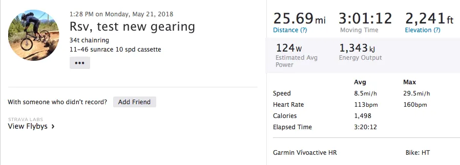
GPS data uploaded to Strava

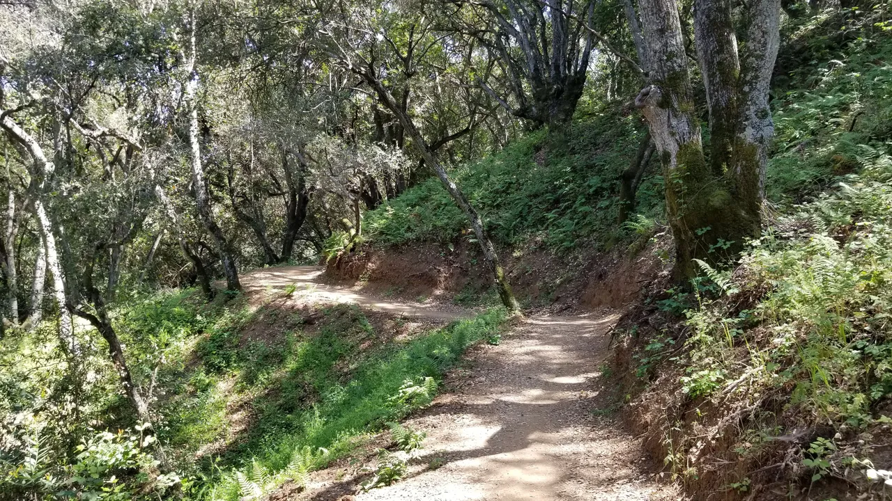
The landscape and ground cover changes quite a bit as the elevation changes. There is a lot of tree cover on the upper mountain with small feeder streams going to Calero reservoir. This makes for some lush almost tropical environment with bright green ferns.

Calero reservoir in the distance.

A shot of the double track in the upper portion of the mountains. It's really fun coming back down =)
At the top, this is a shot of Mt Umunhum which is the tallest peak in the range. The US Airforce installed a radar station back in 1958 during the 'cold war' and was active until 1980. The tower was looking for potential attacking aircraft that were arriving from the pacific ocean. (Can you see the small tower on the top?)

Here is a shot of Mt Umunhum from Jitze Couperus of Los Altos Hills, CA. It was closed off for years due to asbestos contamination at the tower. It is now open to the public as a park. There is a dirt path that I will eventually ride and report on.

For reference, here is the location of Mt Umunhum from Google maps.

I needed easier gearing for getting up 15% to 20% grades, yes that is STEEP and I'm not a youngster.... =) Mtb'ing in the bay area has plenty of very steep climbs, some that you need to mentally prepare for before starting. (You know you in for some suffering)
The front chain ring is now a 34 tooth from a 32 tooth.
The rear cassette is now a 11-46 tooth from a 11-40 tooth.
Sram GX shifter and long cage derailleur.
KMC 10 speed chain.
